
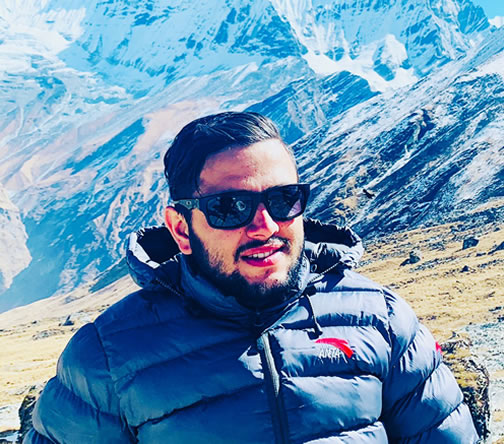
 Recommended On
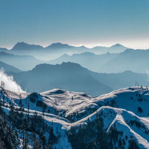
Mount Everest is the highest mountain in the world at 8,848.86 meters. It stands in the Himalayas between Nepal and Tibet (China). This comprehensive Mount Everest guide explains the mountain’s geography, climbing routes, survival risks, expedition systems, and important facts that climbers research before entering the Everest region.
Mount Everest receives global attention because it combines extreme altitude, commercial expeditions, historical climbing achievements, and real fatality risk. Many people search for Mount Everest information to understand the Death Zone, Khumbu Icefall, summit traffic, and why climbing Everest remains one of the hardest high-altitude expeditions on Earth.
This guide covers the South Col Route, North Ridge Route, Everest Base Camp elevation, Khumbu Icefall danger, Rainbow Valley, Hillary Step, summit statistics, Everest death toll, and modern Mount Everest climbing facts. It also explains why acclimatization, weather windows, and expedition logistics matter more than physical fitness alone.
For trekkers and climbers visiting Nepal, Everest is not only a mountain. It is a complete high-altitude system involving Sherpa support teams, fixed-rope networks, oxygen logistics, glacier movement, and strict timing around Himalayan weather patterns.
Why Mount Everest Is Different From Other Mountains
Mount Everest is not famous only because of its height. The mountain combines extreme altitude, commercial expedition systems, technical glacier crossings, and severe survival pressure above 8,000 meters.
Unlike many Himalayan trekking peaks, Everest requires weeks of acclimatization before a summit push. Climbers must manage oxygen systems, weather windows, fixed ropes, and high-altitude fatigue carefully.
Why Everest Is Globally Searched
People search for Mount Everest information because the mountain represents the highest point on Earth. Others want Mount Everest climbing facts about Death Zone survival, Everest deaths, Khumbu Icefall danger, and summit success rates.
Everest also attracts trekkers who want Everest Base Camp experiences without attempting the summit itself.
|
Why Everest Is Unique |
Explanation |
|
Highest Mountain |
8,848.86 meters |
|
Death Zone |
Above 8,000 meters |
|
Historic Climbs |
Hillary and Tenzing first ascent |
|
Commercial Expeditions |
Large-scale guided climbing |
|
Global Recognition |
Most searched mountain worldwide |
In short, Mount Everest is different from other mountains because it combines extreme altitude, expedition logistics, glacier danger, and Death Zone survival pressure.
Where Is Mount Everest Located?
Mount Everest is located in the Himalayas on the border between Nepal and Tibet (China). The southern side belongs to Nepal inside the Khumbu Region, while the northern side lies in the Tibet Autonomous Region under China.
Most expeditions use Kathmandu as the starting city before flying to Lukla Airport and trekking toward Everest Base Camp. The Nepal side is more popular because it offers stronger expedition logistics, better rescue access, and a larger Sherpa support network.
The Tibetan side accesses Everest through the North Ridge Route. That route involves longer vehicle access and stricter political permit systems. Climbers researching where Mount Everest is located usually compare the Everest Nepal or China access systems before choosing a route.
Quick Everest Geography Facts
|
Feature |
Details |
|
Mountain Range |
Himalayas |
|
Elevation |
8,848.86 meters |
|
Nepal Side Region |
Khumbu Region |
|
Tibet Side Region |
Tibet Autonomous Region |
|
Main Expedition Hub |
Kathmandu |
|
Popular Climbing Side |
Nepal South Col Route |
In short, Mount Everest is located between Nepal and Tibet (China) in the Himalayas. The Nepal side connects through the Khumbu Region and is the most popular route for Everest expeditions due to stronger logistics and rescue infrastructure.
Mount Everest Map Explained
The Mount Everest map mainly focuses on two major climbing systems: the South Col Route from Nepal and the North Ridge Route from Tibet. Both routes eventually connect to the summit ridge but involve different technical and environmental challenges.
The South Col Route starts from Everest Base Camp in Nepal and passes through the Khumbu Icefall, Camp I, Camp II, Camp III, Camp IV, and finally the summit. This route has more expedition support, fixed ropes, and oxygen logistics.
The North Ridge Route approaches Everest from Tibet. Climbers move through advanced base camps before ascending exposed ridge sections with stronger wind exposure and colder summit conditions.
Everest Route Map Structure
|
Route |
Starting Side |
Main Difficulty |
|
South Col Route |
Nepal |
Khumbu Icefall |
|
North Ridge Route |
Tibet |
Wind exposure and technical ridge climbing |
Key Everest Camps
|
Camp |
Approximate Elevation |
|
Everest Base Camp |
5,364m |
|
Camp I |
6,065m |
|
Camp II |
6,400m |
|
Camp III |
7,200m |
|
Camp IV |
7,950m |
|
Summit |
8,848.86m |
Everest Base Camp Elevation
Everest Base Camp elevation differs depending on the climbing side. The South Base Camp in Nepal sits at approximately 5,364 meters, while the North Base Camp in Tibet is around 5,150 meters.
Many people incorrectly assume Everest Base Camp is close to the summit push. In reality, climbers spend several weeks rotating between camps for acclimatization before attempting the summit.
High altitude acclimatization is essential because oxygen levels at Everest Base Camp are already nearly 50 percent lower than sea level. Most expeditions spend 40 to 60 days adapting before a summit attempt.
Why Acclimatization Matters
-
Reduces altitude sickness risk
-
Improves oxygen adaptation
-
Helps the body recover between rotations
-
Increases summit success probability
Khumbu Icefall: The Most Dangerous Section
The Khumbu Icefall lies between Everest Base Camp and Camp I on the South Col Route. It is one of the most dangerous sections of Mount Everest because the glacier constantly moves and changes shape.
Climbers cross aluminum ladders over deep crevasses while attached to fixed ropes. Ice towers called seracs can collapse without warning. Most teams start crossing the icefall between 2 AM and 5 AM because colder temperatures reduce glacier movement.
The Khumbu Icefall changes every season. Sherpa icefall doctors rebuild ladder systems and rope lines repeatedly during expeditions due to shifting glacier conditions.
Why Khumbu Icefall Is Dangerous
|
Danger |
Explanation |
|
Glacier movement |
Ice shifts daily |
|
Serac collapse |
Ice towers can fall suddenly |
|
Crevasses |
Deep, hidden cracks in the glacier |
|
Ladder crossings |
Balance risk above ice gaps |
|
Traffic delays |
Climbers exposed longer |
Crossing the Khumbu Icefall usually takes 5 to 7 hours, depending on ladder conditions and climber traffic. Temperatures often drop below -15°C before sunrise during summit season.
Death Zone of Mount Everest
The Death Zone begins above 8,000 meters. At this altitude, oxygen levels fall below the human survival threshold for extended exposure. This is one of the most important Mount Everest climbing facts that climbers must understand before an expedition.
Inside the Death Zone, the body slowly deteriorates even while resting. Decision-making becomes weaker due to hypoxia. Climbers often experience confusion, hallucinations, severe exhaustion, and slowed movement.
Most expeditions use supplemental oxygen above Camp III or Camp IV. Even with oxygen support, summit climbers face frostbite risk, exhaustion, collapse, and rapid weather changes.
Death Zone Survival Challenges
-
Severe oxygen depletion
-
High hypoxia risk
-
Tissue degradation
-
Frostbite exposure
-
Reduced mental performance
Typical Summit Push Timing
|
Stage |
Approximate Duration |
|
Camp IV to Summit |
8 to 12 hours |
|
Summit to Camp IV return |
4 to 6 hours |
At 8,848 meters, the summit contains roughly one-third of the oxygen available at sea level. Climbers can lose several kilograms during a single summit rotation due to dehydration and extreme energy expenditure.
Rainbow Valley Mount Everest
Rainbow Valley is located near the summit route on Mount Everest. The area gained its name from the brightly colored down suits and equipment of deceased climbers remaining on the mountain.
This section represents one of the harsh realities of high-altitude mountaineering. Recovery operations above 8,000 meters are extremely difficult because helicopters cannot safely operate at summit altitude and rescuers face severe oxygen limitations.
Many travel blogs describe Rainbow Valley dramatically. In reality, expedition teams treat the area with caution and respect because it reflects the physical limits of high altitude survival.
North Face of Mount Everest
The North Face route approaches Mount Everest from Tibet through the North Ridge Route. This side is generally considered more technical due to harsher wind exposure and colder summit conditions.
The Tibet side avoids the Khumbu Icefall but introduces steeper ridge climbing and longer exposure to strong jet stream winds. Rescue access is also more limited compared to Nepal.
Some experienced climbers prefer the North Face because it has lower traffic during certain seasons. However, the route demands stronger technical climbing ability and colder weather tolerance.
South Route vs North Route
|
Feature |
South Col Route |
North Ridge Route |
|
Starting Country |
Nepal |
Tibet |
|
Most Dangerous Section |
Khumbu Icefall |
Exposed ridge climbing |
|
Rescue Access |
Better |
Limited |
|
Technical Difficulty |
Moderate-high |
High |
|
Weather Exposure |
High |
Very high |
Hillary Airport Nepal (Lukla Airport)
Tenzing Hillary Airport in Lukla is the main air gateway to the Everest region. Many climbers and trekkers search for what the Hillary airport in Nepal is referring to, Lukla Airport.
The airport sits at approximately 2,845 meters and has one of the shortest commercial runways in the world, at about 527 meters long. The runway ends near steep mountain terrain, making weather conditions extremely important for flights.
Flight delays are common during poor visibility or strong wind conditions. Most Everest expeditions build extra buffer days into their itineraries because Lukla weather frequently disrupts transportation schedules.
Why Lukla Airport Is Considered Dangerous
-
Short mountain runway
-
Fast weather changes
-
High altitude landing conditions
-
Limited go-around options for pilots
Everest Sleeping Beauty Explained
The phrase “Everest Sleeping Beauty” appears in some travel blogs and online discussions. It is not an official mountaineering term used in expedition operations.
In many cases, the phrase refers to snow formations or symbolic descriptions of Everest’s appearance. Some internet content also incorrectly connects the phrase to mountaineering tragedies, creating confusion for readers searching for accurate Mount Everest information.
Professional expedition teams focus on weather systems, acclimatization schedules, oxygen logistics, and route safety rather than symbolic mountain descriptions.
How Many People Have Climbed Mount Everest?
More than 11,000 successful Everest summits have been recorded since the first confirmed ascent in 1953 by Edmund Hillary and Tenzing Norgay.
Commercial expeditions have increased summit numbers significantly during the last two decades. Improved weather forecasting, fixed rope systems, and supplemental oxygen logistics have made Everest more accessible to experienced high-altitude climbers.
However, climbing Everest still requires months of preparation, technical support teams, acclimatization, and significant financial investment.
Everest Climbing Statistics
|
Fact |
Approximate Number |
|
First successful summit |
1953 |
|
Total recorded ascents |
11,000+ |
|
Main summit season |
April to May |
|
Typical expedition length |
45 to 65 days |
How Many People Have Died on Mount Everest?
Over 300 recorded deaths have occurred on Mount Everest. The main causes include altitude sickness, exhaustion, avalanches, falls, hypoxia, and severe weather exposure.
Rescue operations above 8,000 meters are extremely limited because helicopters cannot safely perform summit evacuations. Climbers often depend on teammates and Sherpa support during emergencies.
The death-to-summit ratio has improved compared to earlier decades due to better weather forecasting and expedition logistics. However, Everest remains one of the world’s highest-risk climbing environments.
Common Everest Fatality Causes
-
Hypoxia
-
Frostbite
-
Avalanche exposure
-
Falls on fixed ropes
-
Exhaustion during descent
Hillary Step Explained
The Hillary Step is a steep rock section near the Everest summit at approximately 8,790 meters. Historically, it acted as a major bottleneck during summit pushes on the South Col Route.
Following the 2015 Nepal earthquake, many climbers reported physical changes to the rock structure. Fixed ropes now help climbers pass the section during summit attempts.
Even though the terrain may appear smaller today, congestion near the Hillary Step still creates serious delays during crowded summit windows.
During heavy summit traffic, climbers can wait more than two hours near the Hillary Step while exposed to Death Zone oxygen levels and freezing wind conditions below -25°C.
Khumbu Icefall vs Hillary Step
The Khumbu Icefall and Hillary Step create different types of climbing danger on Mount Everest. The Khumbu Icefall is dangerous because of unstable glacier movement and serac collapse risk.
The Hillary Step becomes dangerous due to climber congestion, exposure, exhaustion, and limited movement near the summit ridge inside the Death Zone.
One section tests glacier survival skills early in the expedition, while the other challenges climbers during summit exhaustion at extreme altitude.
Everest Routes Comparison
The South Col Route from Nepal is the most common Everest climbing route because it offers stronger logistics, more Sherpa support, and better rescue coordination.
The North Ridge Route from Tibet is colder, windier, and more technical. Climbers on the Tibet side often experience harsher jet stream exposure and longer ridge traverses.
Everest Route Comparison Table
|
Factor |
South Col Route |
North Ridge Route |
|
Popularity |
Higher |
Lower |
|
Logistics |
Better |
More limited |
|
Rescue Access |
Stronger |
Weaker |
|
Technical Sections |
Moderate-high |
High |
|
Wind Exposure |
High |
Very high |
Death Zone Survival Strategy
Surviving the Death Zone depends on timing, oxygen systems, weather windows, and efficient movement. Climbers cannot remain safely above 8,000 meters for long periods.
Expedition teams monitor jet stream movement carefully before summit pushes. Fixed rope systems help reduce climbing delays, while supplemental oxygen improves survival and decision-making ability.
Sherpa support plays a major role in carrying oxygen cylinders, fixing ropes, and guiding climbers through high-risk sections.
Golden Rules for Death Zone Safety
-
Keep the summit movement slow and steady
-
Hydrate even in freezing conditions
-
Use oxygen correctly
-
Turn around if the weather changes rapidly
-
Avoid long delays near bottleneck zones
Climbing Everest Difficulty Explained
Many people ask if Everest is technically difficult. The bigger challenge is altitude, not advanced rock climbing. Everest climbing difficulty mainly comes from oxygen depletion, weather exposure, and long summit duration.
Climbers face weeks of acclimatization, freezing temperatures, glacier crossings, avalanche exposure, and severe exhaustion. Even experienced mountaineers struggle with movement above 8,000 meters.
Most successful Everest climbers already have prior high altitude experience on peaks above 6,000 or 7,000 meters before attempting Everest.
Main Everest Difficulty Factors
|
Challenge |
Impact |
|
Altitude fatigue |
Slows movement |
|
Hypoxia |
Reduces mental clarity |
|
Weather |
Creates summit delays |
|
Avalanche exposure |
Adds objective risk |
|
Long summit push |
Causes exhaustion |
Common Risks on Mount Everest
Mount Everest contains multiple objective dangers that cannot be completely removed even with strong expedition planning. Weather systems can shift rapidly within hours.
Hypoxia and frostbite remain major risks during summit pushes. Avalanche zones near the Khumbu Icefall and Camp III also create serious hazards during unstable snow conditions.
Traffic jams near the summit have become another modern Everest risk because climbers may spend extra time inside the Death Zone waiting on fixed rope lines.
Common Everest Risks
-
Hypoxia
-
Frostbite
-
Avalanche exposure
-
Exhaustion collapse
-
Falling ice
-
Summit traffic delays
Is Everest Dangerous for Beginners?
Everest is dangerous even for experienced climbers. Beginners should not attempt Mount Everest without years of prior high-altitude mountaineering experience.
Many climbers first complete peaks like Island Peak, Lobuche Peak, Ama Dablam, or 7,000-meter expeditions before Everest. Physical fitness alone is not enough because survival depends on acclimatization, decision-making, and extreme altitude adaptation.
Important Beginner Reality
-
Everest is not a beginner's mountain
-
High altitude experience is essential
-
Summit success depends on acclimatization
-
Weather windows control summit opportunities
Expert Insight: Why Everest Is Not Just a Climb
Everest is a complete expedition system rather than a simple mountain climb. Climbers deal with logistics, weather pressure, oxygen planning, and mental fatigue for nearly two months.
Many summit failures happen because of poor acclimatization timing, delayed decision-making, or exhaustion during descent. The psychological pressure above Camp IV becomes severe due to low oxygen and summit urgency.
Sherpa support teams remain central to Everest expedition success. They manage ropes, oxygen movement, camp setup, and route safety throughout the climbing season.
Best Time to Climb Mount Everest
The best time to climb Mount Everest is during the spring season between April and May. This period offers the most stable summit weather window before the summer monsoon arrives.
During spring, the jet stream temporarily shifts northward, reducing extreme summit winds. Climbers wait carefully for short summit windows when wind speeds become manageable.
Autumn Everest expeditions exist but remain less common because colder temperatures and unstable weather reduce summit success rates.
Everest Weather Facts
|
Season |
Conditions |
|
Spring |
Best summit window |
|
Summer |
Monsoon risk |
|
Autumn |
Colder, unstable |
|
Winter |
Extreme wind exposure |
Successful summit pushes usually happen during short weather windows lasting only 3 to 7 days each season. Summit temperatures can still drop below -30°C even during ideal conditions.
Final Summary: Is Mount Everest Worth Climbing?
Mount Everest remains the ultimate high altitude expedition for many climbers because of its global reputation, historical legacy, and extreme survival challenge.
However, Everest also carries a serious risk. Oxygen depletion, glacier movement, weather changes, and summit fatigue make it one of the most demanding mountaineering environments on Earth.
Climbers considering Everest should first build strong high-altitude experience, understand expedition logistics, and prepare for months of physical and mental training before attempting the summit.
FAQs About Mount Everest
Where is Mount Everest located?
Mount Everest is located in the Himalayas between Nepal and Tibet (China). The southern climbing side lies inside Nepal’s Khumbu Region.
How many people have climbed Everest?
More than 11,000 successful Everest ascents have been recorded since the first summit by Edmund Hillary and Tenzing Norgay in 1953.
How many people have died on Everest?
Over 300 climbers have died on Mount Everest due to altitude sickness, avalanches, falls, exhaustion, and hypoxia.
What is the Death Zone of Everest?
The Death Zone starts above 8,000 meters, where oxygen becomes critically low, and the human body cannot survive for long periods.
What is Khumbu Icefall?
Khumbu Icefall is a dangerous moving glacier section between Everest Base Camp and Camp I filled with crevasses, ladders, and collapsing ice towers.
What is the Hillary Step?
Hillary Step is a steep rock section near Everest’s summit that creates bottlenecks during crowded summit pushes.
What is the Everest Base Camp elevation?
Everest Base Camp on the Nepal side stands at approximately 5,364 meters above sea level.
What is Rainbow Valley Everest?
Rainbow Valley is a section near Everest’s summit route known for visible climbing suits and equipment from deceased climbers.