
 Recommended On
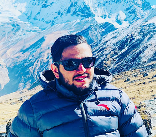
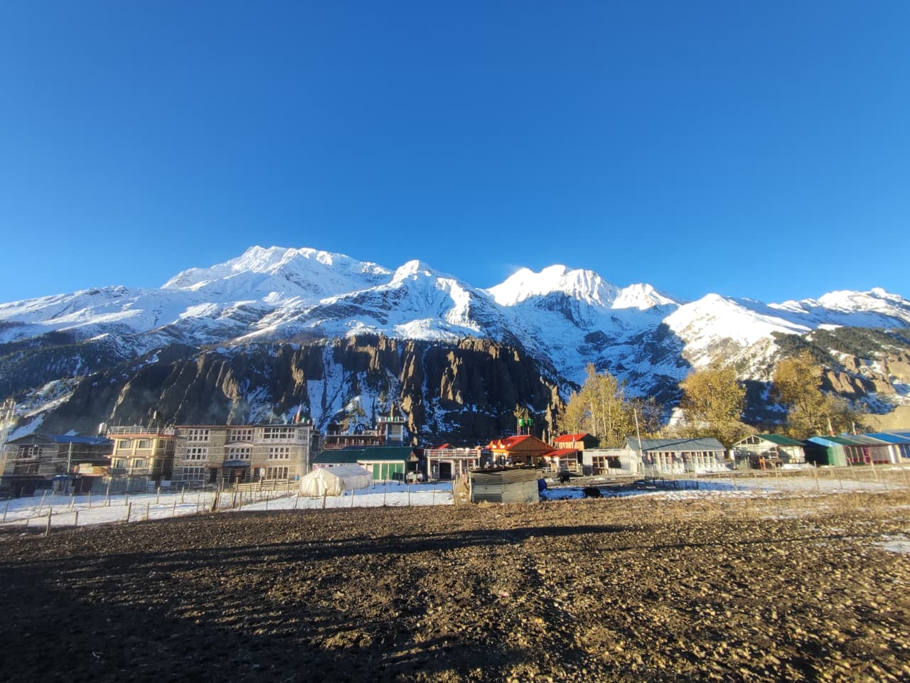
Nepal contains 8 of the world's 14 highest mountains, all above 8,000 meters, concentrated along the southern edge of the Tibetan Plateau. The Nepal Himalayas stretch approximately 800 kilometers from east to west, forming the highest mountain density found in any single country on Earth.
Nepal sits at the collision zone of the Indian and Eurasian tectonic plates. That collision, which began roughly 50 million years ago, pushed the Earth's crust upward and created the Himalayan mountain system. The result is a country where nearly one-third of the land surface sits above 3,500 meters.
Eight peaks cross the 8,000-meter mark within Nepal's borders: Everest, Kanchenjunga, Lhotse, Makalu, Cho Oyu, Dhaulagiri, Manaslu, and Annapurna I. No other region in the world comes close to this concentration of extreme altitude.
The Nepal Himalayas also differ from other mountain ranges in terms of accessibility. The Andes require multi-day drives through remote roads. The Alps are heavily glaciated with short seasons. But in Nepal, trekking routes reach 5,000 meters with established teahouse networks, licensed guide services operating out of Kathmandu, and a functioning permit system that has been refined over 70 years of mountaineering history.
Nepal Himalayas vs Other Mountain Ranges
The Himalaya holds 14 peaks above 8,000 meters. The Andes hold zero. The Alps peak at 4,808 meters (Mont Blanc). The Rockies reach 4,399 meters. For perspective, the average elevation of Nepal's Khumbu region alone exceeds the highest point in most of the world's major ranges.
Technical difficulty and trekking accessibility exist at every level in Nepal. Poon Hill at 3,210 meters takes 4 days from Pokhara. Island Peak at 6,189 meters requires crampons, rope skills, and a climbing permit. Everest at 8,848.86 meters demands months of preparation, a $15,000 USD permit (2026 rate), and elite-level expedition experience.
Map of Nepal Mountains and Himalayan Regions
Nepal is divided into five major mountain regions, each defined by its dominant range cluster, trekking infrastructure, and permit requirements. These regions run from the Khumbu in the east through Annapurna, Manaslu, Langtang, and into the Far-West Himalayan zones.
Major Mountain Regions in Nepal
Everest Region (Khumbu Himal): Located in northeast Nepal, this region contains Everest (8,848.86m), Lhotse (8,516m), Makalu (8,485m), Cho Oyu (8,188m), and dozens of peaks above 6,000 meters. The entry gateway is Lukla airport (2,860m), reached by a 35-minute flight from Kathmandu. The Sagarmatha National Park, a UNESCO World Heritage Site, covers this region. Trekkers require a Sagarmatha National Park entry permit (NPR 3,000) and a Khumbu Pasang Lhamu Rural Municipality permit ($20 USD).
Annapurna Region: Located in central Nepal, above Pokhara city. Contains Annapurna I (8,091m), Annapurna II (7,937m), Annapurna III (7,555m), Annapurna IV (7,525m), Dhaulagiri I (8,167m), and the sacred Machhapuchhre (6,993m). The Annapurna Conservation Area Project (ACAP) permit costs NPR 3,000. The Annapurna Circuit and Annapurna Base Camp routes are the two primary trekking corridors.
Manaslu Region: Located northwest of Kathmandu. Contains Manaslu (8,163m) and Himalchuli (7,893m). The Manaslu Circuit is a restricted trekking area requiring a special restricted area permit ($100 USD per person per week in peak season). This route remains significantly less crowded than the Everest and Annapurna circuits.
Kanchenjunga Region: Located in far-east Nepal near the Sikkim border. Contains Kanchenjunga (8,586m), the world's third-highest mountain. This is Nepal's most remote trekking region. A restricted area permit is mandatory. Kanchenjunga Base Camp treks take 18 to 24 days round-trip from Taplejung.
Far-West Himalaya: Includes Api (7,132m) and Saipal (7,031m). The least visited Himalayan zone in Nepal. Nepal waived climbing permits for 97 peaks through 2027, making this region newly accessible for budget expeditions.
Nepal Himalayan Range System Explained
The Nepal Himalayas consist of three parallel zones running east to west.
The Greater Himalaya holds all 8 of Nepal's 8,000-meter peaks. This is the main ridge system, permanently glaciated above 5,500 meters.
The Lesser Himalaya (also called the Mahabharat Range) runs south of the Greater Himalaya at elevations between 1,500 and 4,000 meters. Pokhara Valley and Kathmandu Valley are both located in this zone.
The Trans-Himalayan zone sits north of the main range, in the rain shadow. Mustang, Dolpo, and Upper Manang are Trans-Himalayan areas with Tibetan plateau characteristics and minimal rainfall.
Where Most High Peaks Are Located
The eastern Nepal Himalayas hold the highest concentration of 8,000-meter peaks. Everest, Lhotse, Makalu, and Kanchenjunga all cluster in the eastern corridor. The western side holds Dhaulagiri, Annapurna, and Manaslu, which are spread across a wider zone. Cho Oyu straddles the Nepal-Tibet border in the central-north section of the Khumbu region.
The 8 Highest Mountains in Nepal (World-Class Peaks)
Nepal holds 8 of the world's 14 mountains above 8,000 meters. These peaks are located across three major Himalayan regions: the Khumbu in the east, the Manaslu-Annapurna zone in the center, and the Dhaulagiri range to the west.
Mount Everest (8,848.86m) - Highest Mountain in the World
Everest, known as Sagarmatha in Nepali and Chomolungma in Tibetan, sits on the Nepal-Tibet border in the Khumbu region. Edmund Hillary and Tenzing Norgay Sherpa made the first ascent on May 29, 1953, via the South Col route.
The 2026 climbing permit for Everest costs $15,000 USD per person, up from $11,000 in previous years. Solo climbing and alpine-style expeditions are no longer permitted as of 2026. New regulations also require death repatriation insurance of at least NPR 5 million (approximately $37,593 USD).
Most trekkers visit Everest via the Everest Base Camp (EBC) trek. The standard EBC route runs 130 kilometers round trip from Lukla, takes 12 to 14 days, and reaches 5,364 meters at base camp. Kala Patthar (5,644m), a 1.5-kilometer hike above Gorak Shep, provides the best unobstructed view of Everest's summit. Temperatures at Kala Patthar average -17 °C in winter and drop to -20°C at the summit level before dawn.
Kanchenjunga (8,586m)
Kanchenjunga is the world's third-highest mountain and Nepal's second-highest. It sits on the eastern border between Nepal and Sikkim, India. The mountain has 5 summits, the highest of which reaches 8,586 meters. It was first summited on May 25, 1955, by George Band and Joe Brown of a British expedition.
This is a restricted trekking region. The Kanchenjunga Base Camp trek takes 18 to 22 days from Taplejung. Trekkers reach both the north base camp (5,143m) and the south base camp (4,780m). A special restricted area permit is required in addition to the standard trekking permit.
Lhotse (8,516m)
Lhotse is the world's fourth-highest mountain and shares the same massif as Everest. The Lhotse-Nuptse ridge forms the southern wall of the Western Cwm on Everest's South Col route. The standard Lhotse climbing route follows the same path as Everest up to Camp III at 7,200 meters before splitting toward the Lhotse Face.
Trekkers on the Everest Base Camp route see Lhotse directly from Kala Patthar and from Dingboche (4,360m) during acclimatization days.
Makalu (8,485m)
Makalu is the world's fifth-highest mountain and one of the most technically difficult 8,000-meter peaks. Its pyramid-shaped summit and sharp ridges give it a distinctive profile visible from the Everest region. The Makalu Base Camp trek (5,700m) is accessible from the Arun Valley and takes 14 to 18 days.
Cho Oyu (8,188m)
Cho Oyu sits on the Nepal-Tibet border, 20 kilometers west of Everest. At 8,188 meters, it is considered the most accessible 8,000-meter peak in the world. The normal route from Tibet is non-technical on the upper sections. The summit success rate for Cho Oyu is among the highest of any 8,000-meter peak, which makes it a common first 8,000-meter objective for experienced high-altitude climbers.
Dhaulagiri I (8,167m)
Dhaulagiri I is the world's seventh-highest mountain and the highest peak in western Nepal. It rises directly above the Kali Gandaki gorge, one of the deepest river gorges on Earth. The east face rises 4,000 meters in near-vertical relief. Average summit temperatures on Dhaulagiri reach -30°C in January, making it one of the coldest climbing objectives in the Nepal Himalayas.
Manaslu (8,163m)
Manaslu, meaning "Mountain of the Spirit" in Sanskrit, is the eighth-highest mountain in the world. It has one of the highest fatality rates among 8,000-meter peaks historically, earning a reputation as an extreme expedition objective. The Manaslu Circuit trek circles the mountain in 14 to 18 days and passes through the Larkya La pass at 5,160 meters.
Annapurna I (8,091m)
Annapurna I is the tenth-highest mountain in the world and the first 8,000-meter peak ever summited. Maurice Herzog led the French expedition that reached the summit on June 3, 1950. Historically, Annapurna I has had one of the highest fatality-to-summit ratios of any 8,000-meter peak, though improved safety protocols have reduced this ratio in recent years.
The Annapurna Base Camp trek (4,130m) reaches the foot of Annapurna I and takes 7 to 10 days from Pokhara.
Famous Trekking Peaks in Nepal (Climbing Peaks Under 7,000m)
Nepal Mountaineering Association (NMA) classifies peaks below 7,000 meters as trekking peaks or expedition peaks. Trekking peaks require an NMA climbing permit ($500 USD), basic crampon and rope skills, and no prior 8,000-meter experience. Nepal has over 300 peaks open for mountaineering.
Mera Peak (6,476m) - Highest Trekking Peak
Mera Peak is Nepal's highest trekking peak. It sits in the Hinku Valley of the Everest region, southeast of Namche Bazaar. The summit route from Mera High Camp (5,800m) follows a glaciated ridge at a moderate angle. No technical rock climbing is required, but fixed ropes, crampons, and ice axes are essential.
The standard Mera Peak trek takes 18 to 20 days from Lukla. The summit panorama includes 5 of the world's 14 highest mountains: Everest, Kanchenjunga, Lhotse, Makalu, and Cho Oyu.
Island Peak (6,189m) - Everest Region Climbing Peak
Island Peak (Imja Tse) sits in the Chhukung valley, east of Dingboche. The peak earns its name from its appearance as an island of rock surrounded by glaciers when viewed from Dingboche (4,360m). The summit day from Island Peak High Camp (5,600m) involves a steep headwall of 50 to 60-degree ice requiring fixed ropes.
Island Peak is commonly combined with the Everest Base Camp trek in a 20 to 22-day itinerary.
Lobuche Peak (6,119m)
Lobuche East sits above the village of Lobuche in the Khumbu. The east ridge route involves a 45-degree ice face and a rocky summit ridge. Most climbers combine Lobuche Peak with the Everest Base Camp trek. The summit offers direct views of Everest, Nuptse, Pumori, and the Khumbu glacier system.
Yala Peak (5,700m)
Yala Peak is in the Langtang region, making it the most accessible trekking peak from Kathmandu. The approach takes 5 to 6 days from Syabrubesi. The summit climb is non-technical, making Yala Peak the best entry-level peak for first-time high-altitude climbers.
Chulu West and Chulu East (Annapurna Region)
Chulu West (6,419m) and Chulu East (6,584m) are located in the Manang district on the Annapurna Circuit route. Both peaks offer a natural acclimatization extension to the Annapurna Circuit. Chulu East is more technically demanding, with mixed rock and ice climbing on the upper ridges.
Most Scenic Mountains and Viewpoints in Nepal
Nepal's five best mountain viewpoints are Poon Hill (3,210m), Kala Patthar (5,644m), Sarangkot (1,592m), Gokyo Ri (5,357m), and Kyanjin Ri (4,773m). Each provides direct sightlines to different sections of the Nepal Himalayas without requiring climbing permits.
Poon Hill - Sunrise Himalayan Panorama
Poon Hill sits at 3,210 meters in the Ghorepani area of the Annapurna region. The sunrise view from Poon Hill covers the Annapurna range from Dhaulagiri I (8,167m) in the west to Machhapuchhre (6,993m) in the east, a panorama spanning approximately 80 kilometers of Himalayan ridgeline.
The Ghorepani Poon Hill trek takes 4 to 5 days from Pokhara and is the most beginner-friendly mountain viewpoint trek in Nepal. Pre-dawn temperatures at Poon Hill reach -5°C to -10°C in winter (December to February). Trekkers should pack a down jacket of at least 600-fill power for pre-dawn summit walks.
Kala Patthar - Closest View of Everest
Kala Patthar (5,644m) is the highest point trekkers can reach in the Everest region without a climbing permit. It sits 1.5 kilometers above Gorak Shep on the south ridge of Pumori. The hike from Gorak Shep takes 1.5 to 2 hours one way, with 400 meters of elevation gain over loose scree and rocky switchbacks.
A critical fact most competitors miss: you cannot see Everest's summit from Everest Base Camp itself. Nuptse (7,861m) blocks the view. Kala Patthar provides the first and clearest unobstructed view of Everest's summit pyramid. At 5,644 meters, oxygen availability at Kala Patthar is approximately 50% of sea-level concentration. Most trekkers depart Gorak Shep before 5 AM to reach the summit for sunrise between 6 and 7 AM, when the wind is lowest and visibility is highest. Winter temperatures at the summit average -20°C before dawn.
Sarangkot - Annapurna Sunrise Viewpoint
Sarangkot (1,592m) sits directly above Pokhara city. It provides a clear sunrise view of the Annapurna range, including Machhapuchhre and Annapurna South. Jeep taxis from Pokhara reach the Sarangkot viewpoint in 30 minutes. No trekking permit is required. This is the most accessible mountain viewpoint in Nepal for first-time visitors.
Kyanjin Ri - Langtang Himal View
Kyanjin Ri (4,773m) sits above the Kyanjin Gompa village in the Langtang valley. The Langtang region is 7 hours by bus from Kathmandu and 4 days of trekking from Syabrubesi. The summit view from Kyanjin Ri includes Langtang Lirung (7,227m), Dorje Lakpa (6,966m), and the Langtang glacier. This is the best mountain viewpoint closest to Kathmandu.
Gokyo Ri - Everest and Turquoise Lakes View
Gokyo Ri (5,357m) overlooks the Gokyo Lakes, a chain of 6 turquoise glacial lakes at 4,700 to 5,000 meters in the Everest region. From Gokyo Ri's summit, trekkers see Everest, Lhotse, Makalu, and Cho Oyu simultaneously. This four-8,000er panorama is unique in the Nepal Himalayas. The Gokyo Lakes trek takes 12 to 14 days from Lukla.
Nepal Mountain Ranges Explained
The Nepal Himalayas consist of four primary sub-ranges: Everest Himal (Khumbu), Annapurna Himal, Manaslu Himal, and Kanchenjunga Himal. Each sub-range has distinct geology, access routes, and trekking infrastructure.
The Everest Himal (Khumbu Himal) contains Everest, Lhotse, Makalu, Cho Oyu, and Ama Dablam (6,812m). This is the most developed trekking region in Nepal with teahouse lodges at every major stopping point from Lukla to Gorak Shep.
The Annapurna Himal contains Annapurna I through IV, Annapurna South, Nilgiri North (7,061m), and Machhapuchhre. The Annapurna Circuit, at 160 to 230 kilometers depending on the route, is the most walked high-altitude trekking circuit in the world.
The Manaslu Himal contains Manaslu (8,163m) and Himalchuli (7,893m). This range sits north of the Gorkha district. The Manaslu Circuit trek follows the Budhi Gandaki River through 10 ethnic villages before crossing Larkya La. Daily permits for this restricted zone cost $100 USD per person per week in autumn and spring.
The Kanchenjunga Himal forms the eastern boundary of Nepal's Himalayan system. Kanchenjunga (8,586m), Jannu (7,710m), and Tent Peak (7,365m) define this range. This is the least trekked major region in Nepal.
Sacred and Mythical Mountains of Nepal
Machhapuchhre (6,993m), known as Fishtail Mountain, is the only peak in Nepal that has never been officially summited and is permanently closed to climbing by the Nepal government for religious reasons.
Machhapuchhre - Sacred Peak
Machhapuchhre translates to "Fish Tail" in Nepali, named for its twin-peaked summit seen from the south. The mountain is sacred to the Hindu god Shiva. Nepal's government has kept it permanently off-limits to climbers since 1964. A British expedition led by Jimmy Roberts came within 50 meters of the summit in 1957 but turned back voluntarily. No permit has been issued since.
From the Annapurna Sanctuary, Machhapuchhre's north face rises in a nearly vertical 3,000-meter sweep from the glacier floor to the summit. No other non-climbable peak in Nepal has a more dramatic visual presence.
Local Cultural Beliefs Around Himalayan Peaks
Sherpa communities in the Khumbu region view Everest (Sagarmatha) as the "Mother Goddess of the Universe." Before major expeditions, Sherpas perform a Puja ceremony at base camp, involving a lama, a stone altar (chorten), food offerings, and prayer flags strung to the high camps. No serious expedition departs from Everest Base Camp without a completed Puja.
Dhaulagiri, Manaslu, and Kanchenjunga are also considered dwelling places of deities in local animist and Buddhist traditions. Climbing rules in these regions include prohibitions against loud noise, littering, and certain foods near sacred zones.
Difficulty Levels of Nepal Mountains
Nepal's mountains divide into three difficulty tiers: viewpoint hiking (no technical skills), trekking peak climbing (basic snow craft), and full expedition peaks (advanced technical climbing and expedition logistics).
Easy Hiking - Mountain Viewpoints
-
Sarangkot (1,592m): 30-minute jeep from Pokhara. No permits, no trekking experience needed.
-
Poon Hill (3,210m): 4-day guided trek from Pokhara. Requires basic fitness.
-
Nagarkot (2,195m): 90-minute drive from Kathmandu. Sunrise Himalayan view with no trekking.
-
Kyanjin Ri (4,773m): 4 days from Kathmandu by road and foot. Basic trekking fitness required.
Moderate Trekking Peaks
-
Yala Peak (5,700m): Non-technical. No prior climbing experience required.
-
Mera Peak (6,476m): Basic crampon skills required. 18 to 20 days from Lukla.
-
Island Peak (6,189m): Fixed rope ascent, 50 to 60-degree headwall. 20 to 22 days with EBC.
-
Lobuche Peak (6,119m): Mixed rock and ice. Combine with the EBC trek.
Technical Expedition Mountains
-
Manaslu (8,163m): $3,000 USD climbing permit. 40 to 50-day expedition.
-
Dhaulagiri (8,167m): One of the most technically complex 8,000-meter routes. The Northwest pillar route involves sustained 60-degree ice.
-
Everest (8,848.86m): $15,000 USD permit (2026). Minimum 8 weeks on the mountain. Death Zone above 8,000m.
-
Annapurna I (8,091m): Historically, the highest-fatality-ratio 8,000-meter peak.
Best Time to See Nepal Mountains
The two best seasons for Nepal mountain trekking are autumn (September to November) and spring (March to May). Autumn offers the clearest skies. Spring combines good visibility with warmer temperatures and the Everest climbing season.
Spring Season (March to May)
Spring is the primary Everest expedition season. Temperatures at Namche Bazaar (3,440m) average 5°C to 15°C during the day in April. The jet stream shifts north from Everest's summit in May, creating stable climbing windows. Rhododendron forests bloom below 4,000 meters in March and April, making lower trail sections particularly scenic.
Spring is the busiest season on the Everest Base Camp route. Expect 200 to 300 trekkers per day at Namche Bazaar in April.
Autumn Season (September to November)
Autumn is the best season for mountain visibility in Nepal. The monsoon ends in September, washing dust from the atmosphere. October delivers the clearest skies of the year across all Himalayan regions. Temperatures at Everest Base Camp (5,364m) range from -5°C during the day to -20°C at night in November.
Annapurna and Manaslu Circuit treks are best done in October for peak conditions.
Winter and Monsoon Conditions
Winter (December to February) allows trekking at lower elevations but brings heavy snowfall above 4,000 meters. The Annapurna Circuit's Thorong La pass (5,416m) often closes due to heavy snow. Everest Base Camp treks remain possible in winter but require full expedition gear.
Monsoon (June to August) brings heavy rain below 3,000 meters and snowfall above 5,000 meters. The Mustang and Dolpo regions, located in the Trans-Himalayan rain shadow, remain dry during the monsoon and attract trekkers in July and August.
How to Experience Nepal Mountains
Nepal's four primary ways to experience the Himalayas are: trekking to mountain base camps, peak climbing expeditions, helicopter and scenic mountain flights, and lodge-based trekking packages. Each has distinct costs, time requirements, and fitness demands.
Trekking to Mountain Base Camps
-
Everest Base Camp (5,364m): 130km round trip from Lukla. 12 to 14 days. Cost: $1,200 to $2,500 USD with a licensed operator.
-
Annapurna Base Camp (4,130m): 7 to 10 days from Pokhara. Cost: $700 to $1,500 USD.
-
Manaslu Base Camp (4,800m): 10 to 12 days. A restricted area permit is required. Cost: $1,500 to $2,500 USD.
-
Kanchenjunga Base Camp (4,780m/5,143m): 18 to 22 days from Taplejung. Cost: $2,500 to $4,000 USD.
Golden Rule: Keep your trekking pack under 13kg. A porter carries heavier loads (up to 25kg per porter), but your day pack should stay light for high-altitude sections above 4,000 meters.
Peak Climbing Expeditions
The Nepal Mountaineering Association classifies trekking peaks from 5,500 to 6,500 meters. NMA permits cost $500 USD per peak. Peaks above 6,500 meters fall under the Ministry of Tourism with separate expedition permit fees. Commercial 8,000-meter expedition packages through licensed operators run $35,000 to $100,000+ USD, depending on the peak and service level.
Mountain Flights and Helicopter Tours
Mountain flights operate from Kathmandu's Tribhuvan International Airport daily during clear weather. The Everest Mountain Flight is a 1-hour morning flight that passes Everest at an altitude of approximately 8,500 meters. Costs range from $180 to $220 USD per person.
Helicopter tours land at Everest Base Camp, Kala Patthar, Annapurna Base Camp, or Gorak Shep, depending on the package. Kathmandu to Kala Patthar helicopter tours take 45 to 60 minutes one way. Cost: $500 to $1,200 USD per person, depending on group size.
Luxury Mountain Experiences
Luxury trekking packages in Nepal include accommodation at the Yak and Yeti (Kathmandu), the Base Camp Lodge (Namche Bazaar), and the Everest View Hotel (3,880m) above Namche. These packages combine teahouse trekking with private rooms, porter services, and acclimatization monitoring by certified guides.
Risks and Challenges in Nepal Mountains
The three primary risks in Nepal mountain trekking are acute mountain sickness (AMS), avalanche exposure, and remote terrain with limited evacuation options. All 3 risks are manageable with proper planning, licensed guides, and travel insurance.
Altitude Sickness in the Nepal Himalayas
Acute Mountain Sickness (AMS) begins affecting most people above 2,500 meters. Symptoms appear within 6 to 12 hours of reaching a new altitude and include headache, nausea, fatigue, and dizziness. The risk rises sharply above 3,500 meters. Nearly all popular Nepal treks exceed this elevation.
High Altitude Cerebral Edema (HACE) and High Altitude Pulmonary Edema (HAPE) are life-threatening progressions of AMS. The standard response is immediate descent of at least 300 to 500 meters.
Golden Rule: Never ascend to a new sleeping altitude with active AMS symptoms.
Helicopter evacuation from the Khumbu region costs $3,000 to $5,000 USD without insurance. As of 2026, travel insurance with helicopter rescue coverage is mandatory for permit issuance in most Nepal trekking regions. Carry a pulse oximeter to monitor blood oxygen saturation. A reading below 80% at altitude is a warning threshold requiring rest or descent.
Weather and Avalanche Conditions
The Khumbu Icefall on the Everest South Col route is the most avalanche-prone section of any Nepal expedition route. Avalanche risk on Annapurna I's north face is significant during spring. Trekkers on the Annapurna Circuit's Thorong La (5,416m) should cross before 11 AM to avoid afternoon wind and snow conditions.
Sudden weather changes above 4,000 meters can drop temperatures by 15°C within 2 hours. Pack a waterproof shell jacket and an insulated mid-layer regardless of the season.
Remote Terrain and Rescue Limitations
Kanchenjunga, Dolpo, and Upper Mustang treks pass through areas with no road access and limited cell coverage. Rescue response times in these zones can exceed 12 to 24 hours. Trekkers in restricted areas must travel with a licensed Nepali guide. Solo trekking without a guide has been mandatory since the 2023 regulations that require all trekkers to register with a licensed agency.
Why Nepal Mountains Are Globally Unique
Nepal is the only country in the world where 8 mountains above 8,000 meters, 326 peaks open for mountaineering, and a functioning teahouse trekking network operate within a single national border. This combination of altitude density, cultural heritage, and logistical accessibility has no parallel globally.
Highest Mountain Density in the World
Nepal's land area is 147,181 square kilometers, roughly the size of the US state of Arkansas. Within that area, over 1,000 peaks exceed 6,000 meters. The density of extreme altitude within Nepal's borders is unmatched on Earth.
Australia's highest point, Mount Kosciuszko, stands at 2,228 meters. Nepal has more than 100 peaks that exceed Australia's highest mountain by at least 4,000 meters.
Sherpa Heritage and Mountaineering History
The Sherpa people originate from the Solu-Khumbu district of northeast Nepal. Their physiological adaptation to high altitude is distinct: Sherpa genetics include a variant of the EPAS1 gene that improves oxygen processing at extreme altitudes. Sherpas' hemoglobin levels at altitude match non-Sherpa sea-level performance.
Tenzing Norgay Sherpa, who summited Everest with Hillary in 1953, remains the most recognized figure in Nepal mountaineering history. Today, Sherpa guides hold the record for the most Everest summits by any individual climbers. Kami Rita Sherpa holds the record with 29 Everest summits as of 2025.
Nepal Mountains Facts and Records
The table below shows Nepal's 8 highest peaks by elevation, first ascent date, and current 2026 climbing permit cost.
|
Mountain |
Elevation |
World Rank |
First Ascent |
2026 Permit (USD) |
|
Everest |
8,848.86m |
1st |
1953 |
$15,000 |
|
Kanchenjunga |
8,586m |
3rd |
1955 |
$8,000 |
|
Lhotse |
8,516m |
4th |
1956 |
$8,000 |
|
Makalu |
8,485m |
5th |
1955 |
$8,000 |
|
Cho Oyu |
8,188m |
6th |
1954 |
$8,000 |
|
Dhaulagiri I |
8,167m |
7th |
1960 |
$7,000 |
|
Manaslu |
8,163m |
8th |
1956 |
$3,000 |
|
Annapurna I |
8,091m |
10th |
1950 |
$7,000 |
The most technically difficult climbing routes in Nepal are Annapurna I's north face, Dhaulagiri's northeast spur, and Makalu's southeast ridge.
The most popular trekking peaks by annual permit count are Island Peak, Mera Peak, and Lobuche East, in that order.
Planning Your Nepal Mountain Trip
Nepal mountain trekking requires three core permits: a trekking area permit (TIMS card, NPR 2,000), a national park or conservation area permit (NPR 3,000), and a restricted area permit where applicable ($100 to $500 USD per week). All permits are obtained in Kathmandu or at regional checkpoints.
Permits Required for Mountain Regions
-
Sagarmatha National Park (Everest): NPR 3,000 + Khumbu Pasang Lhamu rural municipality fee $20 USD
-
Annapurna Conservation Area: NPR 3,000 (ACAP permit)
-
Manaslu Restricted Area: $100 USD per person per week (autumn/spring), $75 USD (winter)
-
Kanchenjunga Restricted Area: $20 USD per day per person
-
Trekking Peak Climbing (NMA): $500 USD flat rate per peak
TIMS (Trekkers' Information Management System) cards are required for all trekking regions. The card costs NPR 2,000 for individual trekkers and NPR 1,000 for group trekkers. As of 2023, solo trekking without a registered guide or agency is no longer permitted in Nepal.
Packing Checklist for Himalayan Travel
Golden Rules for Himalayan Packing:
-
Keep your total pack weight under 13kg for the main trek bag
-
Hire a porter for loads above 8kg on multiday routes above 4,000 meters
-
Bring a down sleeping bag rated to -15°C for treks above Namche Bazaar
-
Carry a pulse oximeter on any trek above 4,000 meters
-
Pack water purification tablets or a filter to avoid gut illness from stream water
-
Bring trekking poles for descent on rocky terrain above 3,500 meters
-
Layer system: moisture-wicking base layer + fleece mid-layer + waterproof shell
-
Sun protection: SPF 50+ sunscreen, glacier glasses with side shields, and lip balm
Guide vs Solo Trekking Rules (2026)
Since April 2023, Nepal's government has required all foreign trekkers to hire a licensed guide through a registered trekking company. Independent solo trekking is no longer legally permitted. This rule applies to all national park and conservation area treks, including the Everest, Annapurna, and Manaslu regions.
Licensed guides cost $25 to $35 USD per day. Porters cost $20 to $25 USD per day. All licensed guides carry first-aid training certification and altitude sickness response knowledge.
Recommended Nepal Mountain Adventures
World Expedition Nepal offers licensed trekking and expedition packages across all major Himalayan regions. Every package includes a licensed guide, all regional permits, accommodation, and emergency protocol briefings.
Everest Base Camp Trek Packages
The Everest Base Camp trek takes 12 to 14 days from Lukla and reaches 5,364 meters. The route passes through Namche Bazaar (3,440m), Tengboche Monastery (3,860m), Dingboche (4,360m), Lobuche (4,940m), and Gorak Shep (5,164m) before reaching EBC and ascending Kala Patthar (5,644m) for the Everest summit view.
Annapurna Circuit Trek Packages
The Annapurna Circuit is 160 to 230 kilometers and takes 14 to 21 days. It crosses the Thorong La pass (5,416m), the highest mountain pass on the circuit, and passes through Manang (3,519m), Chame (2,710m), and Tatopani (1,190m). The circuit provides views of Annapurna I, Annapurna II, Gangapurna (7,455m), and Dhaulagiri I.
Manaslu Circuit Trek Packages
The Manaslu Circuit takes 14 to 18 days and crosses Larkya La (5,160m). It is a restricted zone requiring a special permit. Group size minimum applies for restricted area entry. This route is significantly less crowded than the Everest and Annapurna circuits, with a fraction of the daily trekker traffic.
Kanchenjunga Base Camp Trek Packages
The Kanchenjunga Base Camp trek takes 18 to 24 days from Taplejung and reaches both the north base camp (5,143m) and south base camp (4,780m). This is Nepal's most remote major trek. Trekking infrastructure is basic, with fewer teahouses, requiring some camping.
Peak Climbing Expeditions in Nepal
World Expedition Nepal provides guided climbing packages for Island Peak, Mera Peak, Lobuche Peak, and Chulu Peak. Packages include NMA climbing permits, climbing gear support (crampons, harnesses, fixed ropes), acclimatization scheduling, and summit sherpa support.
Plan Your Nepal Mountains Adventure with World Expedition Nepal
World Expedition Nepal is a government-licensed trekking and expedition operator based in Kathmandu. Our team includes certified high-altitude guides and experienced Sherpa climbing staff with direct knowledge of all major Nepal Himalayan routes.
Why Choose World Expedition Nepal:
-
Licensed by Nepal Tourism Board and registered with the Trekking Agencies' Association of Nepal (TAAN)
-
Guides certified in Wilderness First Aid and altitude sickness response
-
All permits handled in-house, including restricted area permits for Manaslu and Kanchenjunga
-
Fixed departure group treks and private custom itineraries are available year-round
-
Emergency evacuation coordination with Kathmandu-based rescue services
Book Popular Mountain Experiences:
-
Everest Base Camp trek with Kala Patthar summit
-
Annapurna Circuit and Annapurna Base Camp
-
Manaslu Circuit with Larkya La crossing
-
Island Peak and Mera Peak climbing packages
-
Everest scenic mountain flights and helicopter tours
Contact World Expedition Nepal to request a custom Nepal mountains itinerary. We provide budget planning, difficulty-based route selection, and group or private departure options across all seasons.
Note: Nepal mountains data reflects 2026 permit fees and regulations. All trekking and expedition packages include licensed guide services as required by Nepal government regulations effective April 2023.
Frequently Asked Questions About Nepal Mountains
What are the highest mountains in Nepal?
Nepal's 8 highest mountains are Everest (8,848.86m), Kanchenjunga (8,586m), Lhotse (8,516m), Makalu (8,485m), Cho Oyu (8,188m), Dhaulagiri I (8,167m), Manaslu (8,163m), and Annapurna I (8,091m). All 8 exceed 8,000 meters in elevation.
How many 8,000-meter peaks are in Nepal?
Nepal holds 8 of the world's 14 mountains above 8,000 meters. All 8 sit within the Nepal Himalayas, concentrated in 3 regions: the Khumbu in the east, the Manaslu-Annapurna zone in the center, and the Dhaulagiri range in the west.
Which is the easiest mountain to climb in Nepal?
Cho Oyu (8,188m) is the easiest 8,000-meter peak. Among trekking peaks, Yala Peak (5,700m) in the Langtang region is the most accessible, requiring no prior technical climbing experience and taking 5 to 6 days from Kathmandu.
Can beginners see Everest without trekking?
Yes. The Everest Mountain Flight from Kathmandu's Tribhuvan International Airport passes Everest at approximately 8,500 meters altitude. The flight takes 60 minutes and costs $180 to $220 USD. Helicopter tours to Kala Patthar offer a ground-level Everest view in 45 to 60 minutes from Kathmandu.
What is the best time to visit Nepal mountains?
October is the single best month to visit Nepal mountains. Skies are clear after the monsoon, temperatures are moderate, and visibility to the Nepal Himalayas is at its annual peak. The full autumn season runs from September through November. Spring (March to May) is the second-best window and coincides with the Everest climbing season
